 |
Day Trips Around Las Cruces, NM
As you can see there are tons of things to do in Las Cruces, but if you feel the itch to get outta town for the day or maybe the weekend, here are some nearby ideas: This list will be growing so check back when you get a chance. |
||
|
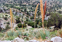
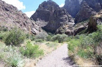
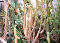
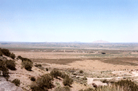
Aguirre Spring Campground The Aguirre Spring Campground is located on the East side of Organ Mountains. From the I - 25/U.S. 70 interchange, go east on U.S. 70 for 14 miles, then turn South on Aguirre Spring Road and go six miles. The road ends at the campground. |
|
|
Bat Caves of Armendaris Ranch The Jornada Bat Caves are located just a few miles from Truth or Consequences, NM, on Ted Turner's 360,000 acre Armendaris Ranch. Amazing sight to see, thousands of bats leaving the cave in the evening and then returning to the cave in the morning. Read more about the caves and view pictures and videos of the bats and a hawk catching bats...click here. |
|
|
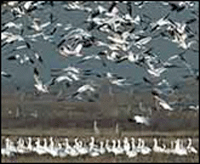
Bosque del Apache National Wildlife Refuge Located between Socorro, NM and Truth or Consequences, NM. Bosque del Apache is Spanish for "Woods of the Apache," and is rooted in the time when the Spanish observed Apaches routinely camped in the riverside forest. Since then the name has come to mean one of the most spectacular National Wildlife Refuges in North America. Here, tens of thousands of birds--including sandhill cranes, Arctic geese, and many kinds of ducks--gather each autumn and stay through the winter. Feeding snow geese erupt in explosions of wings when frightened by a stalking coyote, and at dusk, flight after flight of geese and cranes return to roost in the marshes. M-F 7:30-4:00 PM |
|
|
|
Carlsbad Caverns National Park Really worth a visit. Great daytrip, located in Carlsbad, NM, about 214 miles from Las Cruces. |
|
|
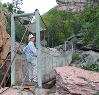
Catwalk National Recreation Trail About 172 miles from Las Cruces in Glenwood, NM. Nice day of hiking along the San Francisco River, fun bridges to cross and the trail is well maintained. |
|
|
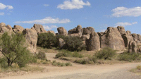
City of Rocks State Park Located between Deming, NM and Silver City, NM. Imagine playing hide-n-seek here! |
|
|
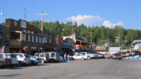
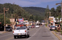
Cloudcroft Nice little mountain community. Shopping, dining, lodging and taking in the fresh mountain air. Up in the mountains outside of Alamogordo, NM. |
|
|
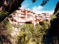
Dripping Springs Just a few miles Southeast of Las Cruces, behind "A" mountain. Well maintained trails and interesting rock formations as well as "dripping springs," especially in the rainy season. |
|
|
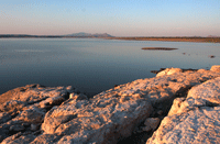
Elephant Butte State Park Large man-made lake right outside of Truth or Consequences, NM. Fishing, water skiing, swimming, boating and camping are just some of the fun things to do at this lake. |
|
|
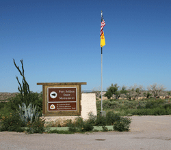
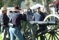
Fort Selden State Park Interesting ruins of the old fort and a nice museum filled with war relics. Cooking demonstrations on Saturdays,
8:30 AM - 1:00 PM. $3.00 per person. Talks on what life was like at the fort on the second Saturday of the month. 8:30 AM - 1:00 PM. $3.00 per person. |
|
|
Fort Stanton State Monument Fort Stanton Monument is open to visitors year round, every day. Tour the grounds or check out the museum. About 10 miles from Lincoln, NM. |
|
|
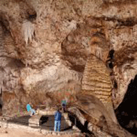
Gila Cliff Dwellings Explore the natural caves of Cliff Dweller Canyon and the village built by ancestors of the Puebloan people who lived in the Mogollon area over 700 years ago. About two hours from Silver City, NM. |
|
|
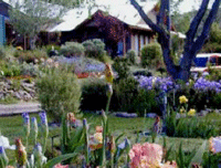
Hondo Iris Farm Bring a picnic lunch, sit in the garden, listen to the birds or photograph the flowers. Near Ruidoso, NM. |
|
|
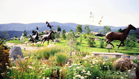
Hubbard Museum of the American West You can not only experience the West, but actually participate as you pass through various portals of time encompassing three area cultures – Native American, Hispanic and Pioneer. It is a living, exciting experience that has something for everyone. Located in Ruidoso Downs, NM. |
|
|
Lincoln State Monument Visitors can see the Old Lincoln County Courthouse with museum exhibits that recount the details of the Lincoln County War and the historic use of the "House" as store, residence, Masonic Lodge, courthouse, and jail. Walk in the footsteps of Billy the Kid, Pat Garrett, and other famous and infamous characters of the Wild West. Located in Lincoln, NM. |
|
|
Living Desert Zoo & Gardens State Park Only two miles from Carlsbad, NM. Lots of desert dwelling creatures and plants.
|
|
|
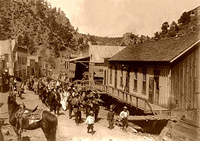
Mogollon A former mining town located in the Mogollon Mountains in Catron County, NM. Just east of Glenwood and Alma. Founded in the 1880s at the bottom of Silver Creek Canyon to support the gold and silver mines in the surrounding mountains. |
|
|
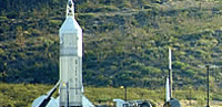
New Mexico Museum of Space History Contains exhibitions ranging from Robert Goddard's early rocket experiments near Roswell to a mock-up of the International Space Station. Located in Alamogordo, NM. |
|
|
Hurd La Rinconada Gallery Located in San Patricio, NM. Originals and prints from the Wyeth and Hurd artists. |
|
|
Rock Hound State Park About 11 miles from Deming, NM. The park has a nice campground, with good facilities, spacious sites and wonderful views of the flat desert land to the west. Visitors are encouraged to prospect and remove specimens, subject only to a 15 pound weight limit, unlike most national and state parks where removing natural objects is forbidden. |
|
|
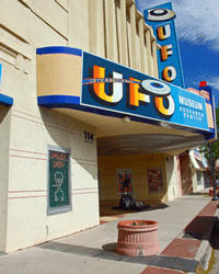
Roswell International UFO Museum The Roswell UFO Museum has a mission of educating the general public on all aspects of the UFO phenomena. The museum maintains its position as the serious side of the UFO phenomena. Located in downtown Roswell, NM. 1-800-822-3545
|
|
|
Ruidoso Lots of things to do in this little mountain town, Skiing, shopping, dining and more. Visit their website at: www.ruidoso.net |
|
|
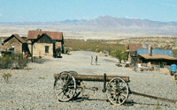
Shakespeare Ghost Town Walk the streets trod by Billy The Kid, John Ringo, Curley Bill, Russian Bill, The Clantons, Jim Hughes and Sandy King and hear stories of the West as it really was. Located right outside Lordsburg, NM. |
|
|
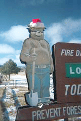
Smokey Bear State Park & Museum Located in Capitan, NM., the park and museum pay tribute to the courageous little bear "Smokey" who became the nation's symbol for preventing forest fires. |
|
|
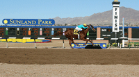
Sunland Park Race Track Enjoy a day at the horse races. Less than an hour from Las Cruces. |
|
|
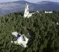
Sunspot National Solar Observatory The observatory is in the Lincoln National Forest, near Cloudcroft, New Mexico. |
|
|
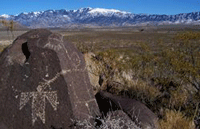
Three Rivers Petroglyph Park Hiking/back-packing, camping, picnicking, interesting petroglyphs. Located 17 miles north of Tularosa, NM, and 28 miles south of Carrizozo, NM. |
|
|
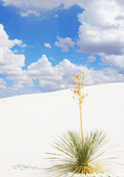
White Sands National Monument White Sands National Monument |
|
|
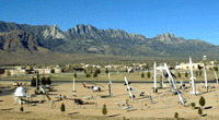
White Sands Missile Range Museum The Museum is open year-round. Free admission. Weekdays 8:00 AM to 4:00 PM and 10:00 AM to 3:00 PM on Saturday. Closed Sundays and Holidays. |
|
|
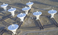
Very Large Array The Very Large Array, one of the world's premier astronomical radio observatories, consists of 27 radio antennas in a Y-shaped configuration on the Plains of San Agustin, fifty miles west of Socorro, New Mexico. |

 |
|

About Las Cruces | Privacy Policy | Site Usage Agreement | Contact Us | Advertise With Us
© Copyright 2023 MeetLasCruces.com - All Rights Reserved Worldwide.